Mobile GIS Mapping Solutions

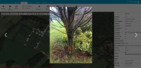
Mobile Geographic Information System (GIS) mapping solutions have revolutionized the way we collect, analyze, and disseminate spatial data. With the increasing availability of mobile devices and the advancements in mobile GIS technology, it has become possible to leverage the power of GIS in the field, enabling users to make informed decisions in real-time. The integration of GIS and mobile technology has opened up new avenues for data collection, mapping, and analysis, making it an essential tool for various industries such as urban planning, natural resource management, emergency response, and transportation.
The advent of mobile GIS mapping solutions has addressed the long-standing challenge of data collection and analysis in the field. Traditional methods of data collection involved manual entry, which was time-consuming, prone to errors, and often resulted in delayed decision-making. Mobile GIS mapping solutions have overcome these limitations by enabling users to collect and analyze data in real-time, using mobile devices such as smartphones, tablets, and handheld GPS devices. This has significantly improved the accuracy and efficiency of data collection, enabling organizations to make timely and informed decisions.
Key Points
- Mobile GIS mapping solutions enable real-time data collection and analysis in the field
- Integration of GIS and mobile technology has improved data accuracy and efficiency
- Mobile GIS solutions support various industries such as urban planning, natural resource management, and emergency response
- Cloud-based mobile GIS solutions offer scalability, flexibility, and cost-effectiveness
- Mobile GIS mapping solutions require careful consideration of data security, privacy, and interoperability
Advantages of Mobile GIS Mapping Solutions

Mobile GIS mapping solutions offer several advantages over traditional methods of data collection and analysis. One of the primary benefits is the ability to collect and analyze data in real-time, enabling users to make informed decisions quickly. Mobile GIS solutions also support offline data collection, which is essential in areas with limited or no internet connectivity. Additionally, mobile GIS solutions can be integrated with other technologies such as GPS, sensors, and drones, enabling users to collect and analyze a wide range of data.
Another significant advantage of mobile GIS mapping solutions is their ability to support collaborative workflows. Mobile GIS solutions enable multiple users to collect and analyze data simultaneously, facilitating real-time collaboration and decision-making. This is particularly useful in emergency response situations, where timely and coordinated decision-making is critical. Mobile GIS solutions also support data sharing and dissemination, enabling organizations to communicate critical information to stakeholders and the public.
Cloud-Based Mobile GIS Solutions
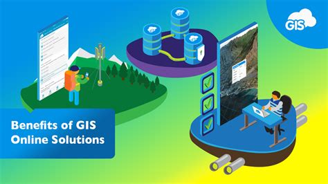
Cloud-based mobile GIS solutions have become increasingly popular in recent years, offering scalability, flexibility, and cost-effectiveness. Cloud-based solutions enable users to access and analyze data from anywhere, using any device with an internet connection. This has significantly improved the accessibility and usability of mobile GIS solutions, enabling organizations to deploy mobile GIS solutions quickly and efficiently. Cloud-based solutions also offer automatic software updates, reducing the burden of maintenance and support.
Cloud-based mobile GIS solutions also support data integration and interoperability, enabling users to integrate data from various sources and systems. This has improved the accuracy and completeness of data, enabling organizations to make informed decisions. Cloud-based solutions also support data security and privacy, ensuring that sensitive data is protected and secure. However, cloud-based solutions also require careful consideration of data ownership, access, and control, to ensure that data is managed and used responsibly.
| Mobile GIS Solution | Key Features |
|---|---|
| ESRI ArcGIS | Data collection, analysis, and mapping; offline data collection; integration with GPS and sensors |
| Google Maps | Location-based services; routing and navigation; data visualization and analysis |
| QGIS | Open-source GIS software; data collection, analysis, and mapping; integration with GPS and sensors |

Challenges and Limitations of Mobile GIS Mapping Solutions

Despite the advantages of mobile GIS mapping solutions, there are several challenges and limitations that must be addressed. One of the primary challenges is data security and privacy, as mobile devices and cloud-based solutions can be vulnerable to cyber threats and data breaches. Additionally, mobile GIS solutions require careful consideration of data ownership, access, and control, to ensure that data is managed and used responsibly.
Another significant challenge is data integration and interoperability, as mobile GIS solutions often require integration with other systems and technologies. This can be time-consuming and costly, requiring significant investment in software development and testing. Mobile GIS solutions also require careful consideration of usability and accessibility, to ensure that users can effectively collect and analyze data in the field. This can be particularly challenging in areas with limited or no internet connectivity, where mobile GIS solutions must be designed to operate offline.
Future Directions for Mobile GIS Mapping Solutions
The future of mobile GIS mapping solutions is exciting and rapidly evolving. One of the key trends is the increasing use of artificial intelligence (AI) and machine learning (ML) in mobile GIS solutions. AI and ML can be used to improve data analysis and visualization, enabling users to gain insights and make informed decisions quickly. Additionally, AI and ML can be used to automate data collection and analysis, reducing the burden of manual data entry and improving data accuracy.
Another significant trend is the increasing use of Internet of Things (IoT) devices and sensors in mobile GIS solutions. IoT devices and sensors can be used to collect and analyze a wide range of data, including environmental, social, and economic data. This can enable organizations to gain a more comprehensive understanding of complex systems and phenomena, and make informed decisions to address pressing challenges and opportunities.
What are the key benefits of mobile GIS mapping solutions?
+Mobile GIS mapping solutions offer several benefits, including real-time data collection and analysis, improved data accuracy and efficiency, and support for collaborative workflows.
What are the key challenges and limitations of mobile GIS mapping solutions?
+Mobile GIS mapping solutions face several challenges and limitations, including data security and privacy, data integration and interoperability, and usability and accessibility.
What is the future of mobile GIS mapping solutions?
+The future of mobile GIS mapping solutions is exciting and rapidly evolving, with key trends including the increasing use of AI and ML, and the integration of IoT devices and sensors.

